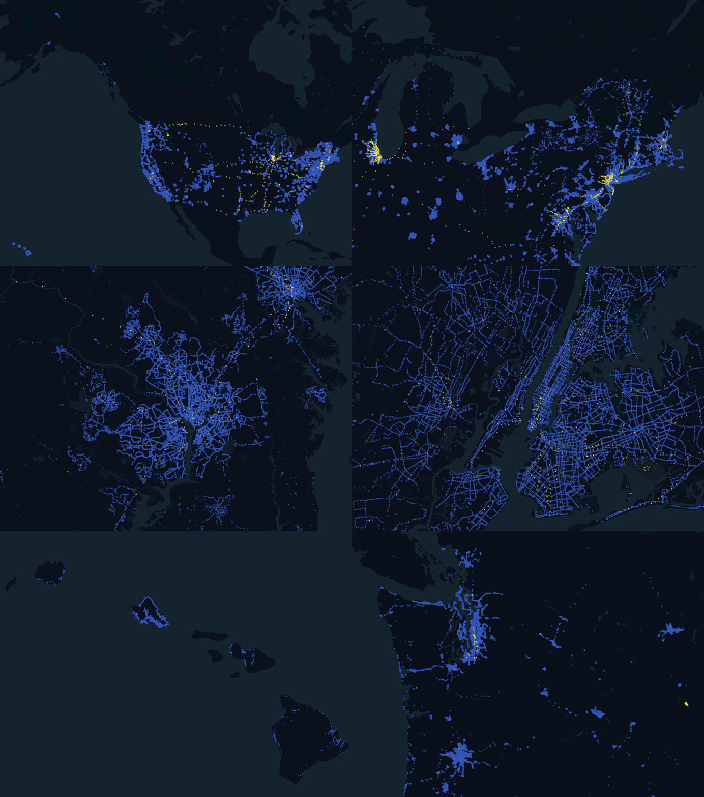
All transit stop across the United States
Overview
Our most commonly requested bulk export from the Transitland platform is a dataset of all transit stops across the United States. This export includes information about the stop/station location itself, as well as the routes that serve that stop. Routes include bus (), train (), subway/metro (), ferry (), and cable car (). Also included in the export is information about the transit agency that operates each route that serves the given stop/station location.

Data from Transitland
Each export includes:
- over 610,000 transit stop locations
- includes stops for buses, trains, subways/metros, ferries, and cable cars
- focused on public transit agencies; also including privately operated shuttles open to the public
- updated on a daily basis
- Transitland Terms provides clear and consistent licensing and attribution
Use cases
Interline’s clients use our standardized US transit stops data product for a wide range of purposes:
real-estate analytics
navigation applications
healthcare access
Data sample
Download a sample to explore in your own software. This sample includes 100 stops randomly selected from across the United States. The full set of columns are included for each.
Please note that this sample may only be used to evaluate this service before purchasing a subscription.
Data dictionary
Here is an overview of the columns provided in the CSV sample.
Columns about the feed from which the stop was sourced:
feed_id- Transitland’s Onestop ID for the source feed. For more information openhttps://www.transit.land/feeds/<replace with feed_id>feed_version_sha1- identifies the feed version from which the stop was sourcedfeed_version_fetched_at- datetime for when the feed version was fetched from the transit operator
Columns about the stop:
stop_onestop_id- Transitland’s ID for the stop location. If multiple agencies provide separate records for the same stop location, they will be merged together into a single Onestop ID, assuming lat/lon and name are very similar. For more information openhttps://www.transit.land/stops/<replace with stop_onestop_id>stop_id- transit operator’s ID for the stopstop_name- name for the stop, provided by transit operatorstop_desc- optional description for the stop, provided by the transit operatorstop_lon- longitude coordinate for the stop locationstop_lat- latitude coordinate for the stop location
Between 1 and 5 agency and route combinations will be defined in a single stop row. At least 1 agency and route combination will serve the stop:
agency_id_1- ID for the transit operator/agency providing service to the stop- agency_name_1 - name of the transit operator/agency providing service to the stop
route_id_1- ID for the route providing service to the stoproute_short_name_1- short name for the route providing service to the stoproute_long_name_1- long name for the route providing service to the stoproute_type_1- vehicle type of the route [* see below for a list of the different route vehicle types]
If additional agency and route combinations serve the same exact stop, additional columns will have values (using the same definitions as above):
agency_id_2agency_name_2route_id_2route_short_name_2route_long_name_2route_type_2agency_id_3agency_name_3route_id_3route_short_name_3route_long_name_3route_type_3agency_id_4agency_name_4route_id_4route_short_name_4route_long_name_4route_type_4agency_id_5agency_name_5route_id_5route_short_name_5route_long_name_5route_type_5
Route types
These are the definitions for the enum integers provided in the route_type_1, route_type_2, route_type_3, route_type_4, and route_type_5 columns.
Defined by the GTFS static specification: https://gtfs.org/reference/static#routestxt
0- Tram, Streetcar, Light rail. Any light rail or street level system within a metropolitan area.1- Subway, Metro. Any underground rail system within a metropolitan area.2- Rail. Used for intercity or long-distance travel.3- Bus. Used for short- and long-distance bus routes.4- Ferry. Used for short- and long-distance boat service.5- Cable tram. Used for street-level rail cars where the cable runs beneath the vehicle, e.g., cable car in San Francisco.6- Aerial lift, suspended cable car (e.g., gondola lift, aerial tramway). Cable transport where cabins, cars, gondolas or open chairs are suspended by means of one or more cables.7- Funicular. Any rail system designed for steep inclines.11- Trolleybus. Electric buses that draw power from overhead wires using poles.12- Monorail. Railway in which the track consists of a single rail or a beam.
Pricing & Purchase
Single Download
$2,950 / download
- Over 610,000 transit stops across the US
- Standardized format (see above)
- Convenient payment by credit card
Subscription
Contact us for discounts
- Update your stops data quarterly (4x a year), semi-annually (2x a year), monthly, or more frequently and receive a discount
Need stops for the 50+ other countries covered by Transitland? Need data exports in an alternative format? Or have other requirements to discuss, see our custom bulk transit data services.